

Monthly Archives: December 2012
22 DecCVE Aerial Photos
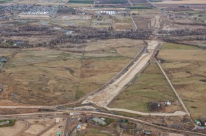
The first photograph looks north along the SH-16 alignment from the Phyllis Canal/Joplin Road area toward the Boise River Bridge and SH-44 in the distance. November 29th, 2012 The second photograph looks south from SH-44 at the SH-16 alignment showing the Boise River Crossing and Phyllis Canal in the distance. November 29th, 2012 The third photograph shows [...]
Read More ...